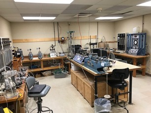
Our geotechnical engineering experts understand how to identify and mitigate ground-related risks through rigorous investigation, analysis and design. We know that what’s below the surface can be as crucial and complex as the structure it supports. We can deliver site investigation projects of the highest quality with a large team of drilling crews, site supervisors, field technicians, geotechnical and geo-environmental engineers, geologists, all supported by an experienced management team.
GeoConsult Associates is at the forefront of the industry and have delivered variety of the most complex and technically challenging site investigations undertaken in all over Pakistan. Our firm owns and operates some of the biggest and most technologically advanced drilling rigs in the country.
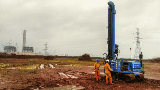
Our geotechnical engineers continually contribute to interesting and challenging projects. We understand the impact on surrounding assets due to ground and structural movements. Our team approach to geotechnical engineering extends beyond simply providing engineering data. We educate our clients about the risks and benefits of the engineering recommendations we make. We develop geotechnical investigations programs in support of each client’s project. We have completed large scale schemes across all construction sectors.
Services include:
- Percussion Boreholes
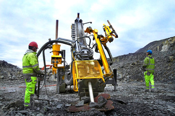
- Rotary Coring and Non-coring Drilling
- Wireline Drilling
- Augur Drilling
- Percussion Boreholes
- Machine & Hand-Dug Test Pits
- Cone Penetration Test (CPT)
- Standard Penetration Test (SPT)
- Trial Pitting and Trenching
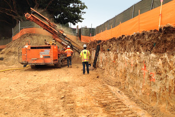
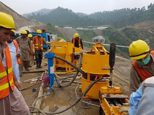
We are providing drilling and grouting services since 1986 for ground treatment services. A wealth of experience has been gained through successfully completing hundreds of contracts. Experienced management teams, site staff and field operatives utilizing our fleet of company owned plant provide a comprehensive service, which has facilitated the successful completion of some of the country’s largest ground treatment and stabilization projects. Our flexible approach and access to extensive in-house resources allow us to undertake projects of any size, from smaller, more technically challenging projects to large-scale treatment schemes.

GeoConsult Associates is one of Pakistan’s leading specialist drilling and grouting contractors providing innovative and ground improvement solutions across all sectors. Our geotechnical engineers work in multi-disciplinary teams, providing solutions on projects as diverse as the infrastructure and construction industry, power and energy, land management, environmental rehabilitation, transportation and utilities.
Geoconsult Associates offer a range of services in drilling and grouting, including:
- Drilling and grouting for tunnels
- Compaction Grouting
- Embankment stabilization
- Pressure grouting
- Specialist drilling services
- Pipeline “spot” grouting
- Underwater grouting
- Grout curtain formation
- Reservoir treatment schemes
The hidden nature of many of Pakistan’s land has meant wealth and a road to prosperity. In this regard, our team of geologists intends to impart their role by offering services for the identification, prospection and processing of mineral deposits hidden in the precious lands of Pakistan. We have expertise of mineralogy, petrology and advanced mineralogy discipline having vast experience background.
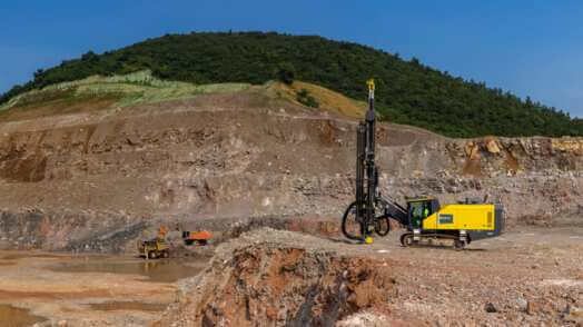
We have successfully completed large scale mineral estimation and exploration projects of national importance in Pakistan. We have collaborations with International firms to cater to multi-dimensional projects. Our experience, expertise and in-depth knowledge of geotechnical construction processes ensures we offer the optimal cost, program and quality balance.
The offered services include:
- Geological mapping with special emphasis on demarcation of mineral zones with respect to grades
- Execution and resident supervision of detailed studies for resource estimation and exploration
- Geophysical and Geological surveys for mineral explorations
- Execution / Supervision of Deep drilling and sampling of ore bodies
- Mineral assay
- Review/ interpretation of exploration data
- 3D modelling and report generation for Surface/ Subsurface Metallic and Non-metallic mineral resources
GeoConsult Associates has also been giving services in groundwater investigations. In this regard, field investigations are carried out for exploration of groundwater resources. The scope of services includes electrical resistivity survey, groundwater well inventory, performance of well capacity testing and aquifer testing, and groundwater modeling. GeoConsult Associates also provides services for geophysical well logging for the design of tube wells.

We provide the experience and technical skills needed to successfully and cost-effectively manage the groundwater needs of your operation. Our geologists, hydrogeologists, and geochemists undertake all aspects of groundwater studies. We provide services related to groundwater quality and quantity including resource exploration, pollution evaluation, and remediation design. Modelling specialists develop site-specific conceptual and detailed models for evaluating and predicting contaminant migration, dewatering, groundwater impacts, and water supply.
Services include:
- Electric resistivity survey
- Groundwater well inventory
- Well pumping test
- Groundwater modeling
- Hydrologic Studies
- Groundwater Monitoring and Control
- Tubewell installation
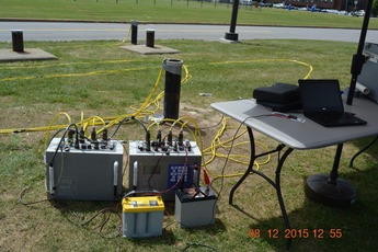
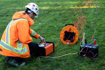
Geophysical surveys investigate the physical properties of the ground by the use of instrumentation, providing information on subsurface ground conditions not evident from the ground surface, for all types of practical engineering applications. Geophysical surveys are non-intrusive and non-invasive, and can help to avoid the disruption that can be caused by drilling, pitting and trenching. A geophysics investigation can cover large site areas rapidly to provide either reconnaissance data or a detailed investigation, and can optimise the targeting of any essential intrusive inspections. In environments where intrusive ground investigations are not possible, a geophysical investigation can still provide engineers with useful information.
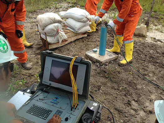
We provide geological and geophysical surveys from our offices around the world and our geologists and geo-scientists are supported by advanced technologies, systems, and state-of-the-art equipment. We assist with determining ideal construction sequencing, preparing creative yet practical geotechnical solutions and our senior staff provide on-going support during construction.
Geophysical investigation methods provided by GeoConsult Associates are:
- Resistivity survey
- Seismic refraction
- Downhole/Crosshole Seismic Survey
- Electrical resistivity Tomography
- Vertical Electrical Sounding
- Thermal Conductivity
- Borehole Geophysical logging
- Borehole Videography
- Ground Penetrating Radar (GPR)
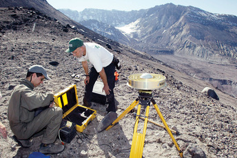
Years of experience in delivering spatial services, the dynamic team of experts provide our clients with best practice surveying and geographic information system (GIS) services for engineering, construction, monitoring, infrastructure, rail, road, and land developments. Our experienced multi-disciplinary team and strategic technical and service partnerships position us to provide the best outcomes for our clients, both private and government, across all surveying and spatial fields.
Working to the highest standards of professionalism, we provide efficient and innovative spatial solutions that empower our clients to confidently make informed decisions.
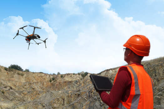
Before you begin construction on a new project, you need quality land surveying services to protect your investment. Using advanced geospatial tools, our highly experienced land surveyors and engineers will provide you with the valuable data you need to accurately map and develop your land. By offering every available geospatial survey tool and the experts to operate them, our land surveying team provides clients with meaningful data to operate far more efficiently.
Surveying and Spatial Services include;
- Site Topographic Surveys
- Spatial analysis
- Mapping
- 3D modelling and visualization
- Photogrammetry (Aerial Surveys)
- Mine Surveying
- Digital Terrain Model (DTM)
- Land management
- Engineering surveying
- Geodesy
- GIS
- Remote sensing and photogrammetry
Geological mapping is fundamental to any exploration project. Effective mineral exploration requires an in-depth understanding of the lithological and structural controls of mineralisation. These insights must be gained through geological mapping at the early stages of the exploration program.
Mapping is a cost-effective exploration tool and a project-generative process that delivers tangible benefits to all exploration programs. A good geological map not only provides focus to an exploration program, it also clearly communicates the economic potential of a project to stakeholders.
Working to the highest standards of professionalism, we provide efficient and innovative spatial solutions that empower our clients to confidently make informed decisions.
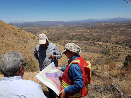
Our exploration team have experience in mapping and the utilisation of drilling information in a variety of commodities and geological settings. Using our knowledge of regional to mine-scale mapping, interpretation of bottom-of-hole geology and coherent interpretation of drilling programs, we can generate high-quality products in a time-efficient manner. Our multi-disciplinary team ensures that the most appropriate datasets, including geophysics, are utilised to generate robust interpretations. We have access to a variety of software packages and can ensure that the data and interpretations generated can be included in subsequent work programs.
Services
- Base mapping
- Structural mapping to define geometry and mineralisation controls at regional to mine scales
- Regolith mapping to support regional geochemical programs
- Alteration mapping to define controls on mineralisation
- Interpretation of multiple datasets in an integrated 3D environment
- Expert analytical support to solve specific issues (e.g. petrography, alteration, age-dating, fluid inclusions)
- 3D Geological Modelling
- Remote Sensing
- Resource Modelling and Estimation
- Geological Mapping and Analysis of Drill Hole Data
- Structural Geology
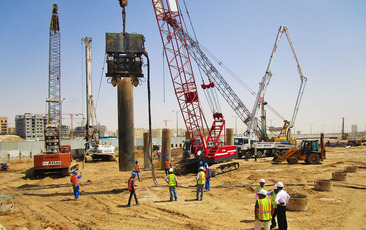
At the core of company policy, our employees ensure quality and conformation to standard procedures. GeoConsult has acquired experience in Piling works in different parts of the country. We have developed the ability to execute piling works in different ground conditions effectively. We aim at increasing our piling operations and inventory to cater to the ever increasing quantum of work in the country.
Mapping is a cost-effective exploration tool and a project-generative process that delivers tangible benefits to all exploration programs. A good geological map not only provides focus to an exploration program, it also clearly communicates the economic potential of a project to stakeholders.
Working to the highest standards of professionalism, we provide efficient and innovative spatial solutions that empower our clients to confidently make informed decisions.
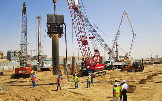
Our experience, expertise and in-depth knowledge of geotechnical construction processes ensures we offer the optimal cost, program and quality balance. We assist with determining ideal construction sequencing, preparing creative yet practical geotechnical solutions and our senior staff provide on-going support during construction.
Our geohazard assessment service includes identification, analysis, risk assessment, mitigation and solution engineering, development and construction projects. Our experienced team of geologists, geophysicists, environmental scientists and geotechnical engineers apply their considerable knowledge and experience to minimize the impact of geohazards on cost, safety and environmental integrity.
Our approach centers on integrating multidisciplinary datasets within a framework of knowledge, based on our vast experience in all types of environments.
The combination of remote sensing data – including seismic, acoustic and laser imagery – and geological and geotechnical samples often forms the basis for our work. Specialist logging, testing and analysis provide further detail. Total integration of all information enables us to determine geohazard risk and complete site-specific probabilistic and post-event analyses.
Mapping is a cost-effective exploration tool and a project-generative process that delivers tangible benefits to all exploration programs. A good geological map not only provides focus to an exploration program, it also clearly communicates the economic potential of a project to stakeholders.
Working to the highest standards of professionalism, we provide efficient and innovative spatial solutions that empower our clients to confidently make informed decisions.
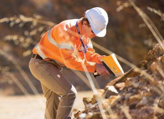
When geohazards can’t be avoided they must be mitigated and their impact reduced to an acceptable level. We provide the platform for geohazards specialists to work seamlessly with geotechnical engineers to address these risks. As well as informing and guiding the engineering design process, based on the sensitivities and parameters of soil units, we advise on the design of remedial actions to rectify immediate issues and mitigate against future potential risks.
Our geohazard services include:
- Identification, evaluation, analysis, modelling and mitigation of land geohazards
- Sediment transport and erosion assessments
- Debris flow and turbidity flow modelling
- Enhanced slope stability analysis, including probabilistic modelling using GIS based analytic tools
- Landslide hazard assessment and seepage studies
- Qualitative and quantitative risk assessment
- Geohazard core logging, geological mapping and trench logging
- Environmental impact assessment and monitoring
- Agricultural development
- Climate change management
- Slope Stability Analysis and Design
- Slope Stabilization Techniques
The need for clean water, flood control, and healthy aquatic environments places increasing demands on the world’s water systems. We offer a comprehensive approach to water resources management with a professional team that includes hydro-geologists, hydrologists, soil scientists and geophysicists, as well as water quality and regulatory specialists.
Our hands-on experience includes hydro-geologic investigations, basin safe-yield investigations; aquifer storage and recovery projects, water quality evaluations, desalination project feasibility studies, groundwater basin management studies and individual well design and well field development investigations.
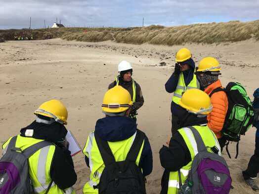
We support you in assessing and understanding the nature of water related challenges and advise on risks and mitigation measures.
Our expertise in high performance data acquisition technologies and our professional services are available for:
- Hydrogeological investigation
- Environmental impact studies
- Water well development
- Salinity assessment studies
- Water quality evaluations
- Groundwater monitoring plans
- Aquifer mapping
- Spatial groundwater planning
- Geo-hydrological numerical modelling
- Surface and groundwater monitoring
- Dewatering of excavations
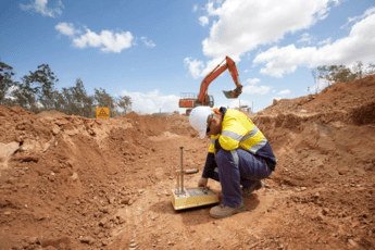
We provide a comprehensive range of field testing services to the industry, with our network of highly qualified engineers. Calling on years of in-depth technical knowledge and understanding, our teams take pride in consistently delivering high-quality field testing services that deliver against detailed contract specifications and standards.
On-site testing enables the certification of areas of construction, supporting continued placement and saving both time and money in the long-run. Our field testing services enable our customers to meet and exceed their obligations, ensuring control and compliance on the most demanding of projects. We are happy to provide advice and guidance as to the most appropriate tests to ensure compliance and will recommend cost-effective, best-practice alternatives where applicable.
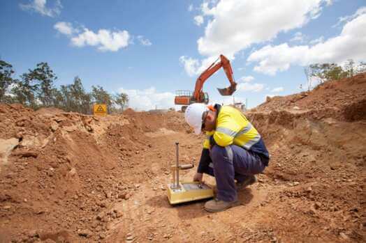
Visual inspection and geotechnical classification of soils is an important primary step in the design and construction of safe, effective earthworks. Predictable performance and stability cannot be assured without accurate characterization of material properties. Our extensive selection of soil/rock testing equipment, products, and accessories for field and laboratory meet ASTM, AASHTO, and other industry standards.
We provide a nationwide sampling and testing service including;
- Field density test
- Dynamic Cone Penetrometer
- Plate load test
- Field permeability test
- Sonic Integrity Testing
- Menard Pressuremeter Tests
- Dilatometer test
We maintain and operate a full service in-house laboratory for geotechnical testing. By having our own in-house laboratory, we are able to promptly begin testing of samples brought from the field. In addition, this also enables us to maintain control over the testing process, making sure all tests are performed in accordance with the appropriate ASTM or AASHTO standards.
We are committed to a high level of quality control. Our laboratory staff is trained in the appropriate testing procedures and our equipment is properly maintained and calibrated. The laboratory is routinely inspected. Our clients can be assured that their test results will be reliable, accurate, and performed in a timely manner.

Our laboratory testing services for soil/rock are on the frontline to conduct high-quality testing, provide accurate and timely test results. Our advancing laboratory quality management systems and technical guidance mandates to have quality control and quality assurance measures in place that ensure the accuracy and precision of the testing process.

